North Elko Lithium Project
Location, Status & Access
The North Elko Lithium Project (NELP) is located about 44 miles (70 kilometers) north-east of Wells, Nevada, and consists of 642 mineral claims covering 20 square miles or 53 square kilometers. It is 100% owned with no royalties outstanding.
Property History & Recent Activity
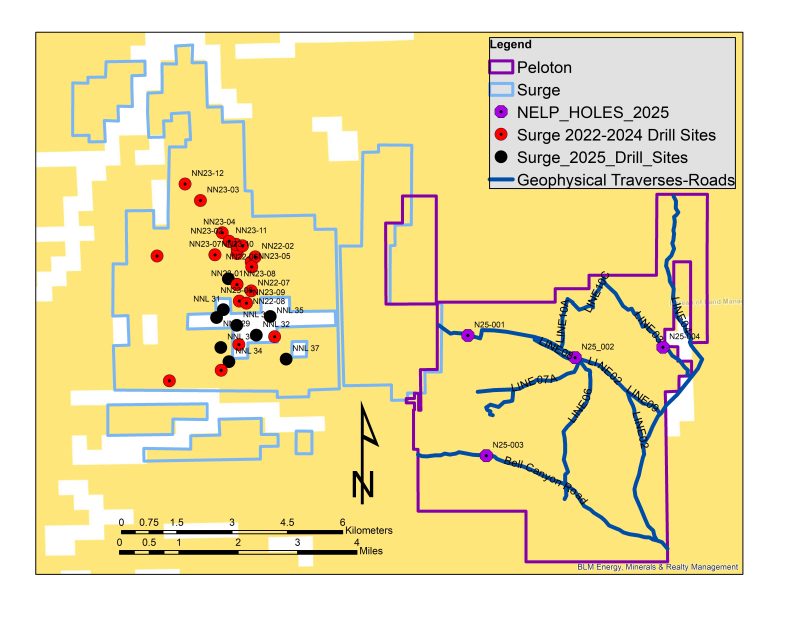
In 2023, Surge Battery Metals Inc. (Surge) made a major lithium in clay discovery on claims that are immediately adjacent to and tied onto the western portion of the NELP claim block. Surge has conducted four drill campaigns and has issued a Preliminary Economic Assessment. Surge has reported an indicated lithium resource of 11.24 million tonnes of Lithium Carbonate Equivalent (LCE) grading an average of 3,010 ppm Lithium. Surge has stated that this is the highest-grade lithium in clay resource in North America (ref: Surge Press Releases dated September 24, 2024 and July 24, 2025).
Geology, Mineralization & Work Done
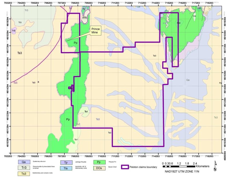
Following the lithium discovery by Surge, Peloton used an airborne hyperspectral minerology mapping technology that identified smectite, hectorite and illite clays in outcrop across the current NELP claim block, suggesting a near surface clay layer exists under most of the property. Smectite, hectorite and illite clays are the predominant lithium bearing minerals at Thacker Pass within the McDermitt Caldera in western Nevada which is the largest known measured and indicated lithium resource in the United States.
After review of the hyperspectral results in 2023, the company embarked on an ambitious staking plan, increasing the ground position from an original 88 claims in the area to the current 642 claims today.
In 2024 and 2025 the Company conducted a multi-faceted exploration program that identified a large paleolake (ancient lake) basin with a mineralized clay bed measuring some 19 square miles or 50 square kilometers.
Exploration concluded to date includes airborne hyperspectral imaging, geologic mapping, prospecting and sampling, grid level soil geochemistry survey at 200 meter spacings over the northern half of the property, grid level X-Ray Diffraction analysis of over 1000 surface outcrop and soil samples, airborne geophysics: magnetics; radiometric; and VLF-EM, surface geophysics: tTEM survey over 37 line kilometers,, and four initial widely spaced drill holes.
- Hyperspectral imaging data shows clay bearing layers outcropping at surface across almost the entire property
- Geologic mapping confirms NELP is within an alkaline paleolake (ancient lake) environment, within a structural graben bounded by northerly-striking normal faults
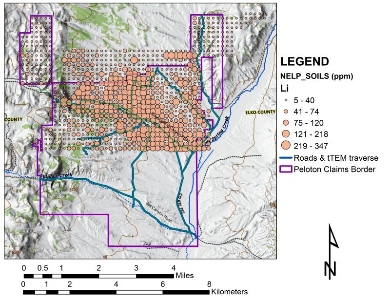
- Soil geochemistry analysis shows an elevated lithium anomaly (up to 18 times background) covering over 25+ square kilometers
- X-Ray Diffraction analysis shows NELP is within bedded alkaline lake sediments and volcaniclastic rocks. The mineralogy of the bedded volcanic rocks is consistent with magmas which are likely additional sources of lithium.
- X-Ray Diffraction has also shown the presence of critical and rare earth minerals that seem uniformly distributed across the property
- Airborne geophysics (magnetics, radiometric and VLF -EM) shows subsurface NW trending structures coincidence with lithium minerals at surface
- iTEM surface geophysics shows an underlying layer, interpreted as clay rich, across almost the entire property
- Two drill permits are in place with 24 drill pads approved
- Four holes were drilled in late 2025 to a maximum depth of 500 feet, that were widely spaced at 7 kilometers by 3.5 kilometers. These holes showed that a mineralized clay bed underlies the property to a depth of at least 500 feet with anomalous lithium, cesium and rubidium in each hole.
- The southern-most hole intersected values that were increasing at depth, with the bottom 155 feet of the hole averaging 618 ppm lithium, 160 ppm rubidium, and 28 ppm cesium. The last sample at the bottom of that hole returned 1,150 ppm lithium, 178 ppm rubidium and 43 ppm cesium.
- Critical minerals, rubidium and cesium, averaged for all four holes 121 ppm rubidium and 16.7 ppm cesium.
- 2026 exploration will refine targets within the large paleolake basin, involve drilling laterally and at depth for horizons that may contain higher grade minerals, and initiate metallurgical test work examining the potential pathways for extraction of critical minerals.
Click Here for the Chronology of Exploration at the North Elko Lithium Project.
Ground Position – Peloton and Surge Battery Metals
Geology Map and Claim Outline
Soil Geochemistry Survey Shows Elevated Lithium Over Large Area
The Texas Canyon claim block (north-western portion of NELP) is also prospective for uranium and hosts a past producing uranium mine. Texas Canyon was featured at the 2022 Geologic Society of Nevada Symposium. Click here for Texas Canyon Uranium.
The Golden Trail claim block (north-eastern portion of NELP) is also prospective for gold and silver. Golden Trail was featured at the 2015 Geologic Society of Nevada Symposium. Click here for Golden Trail.
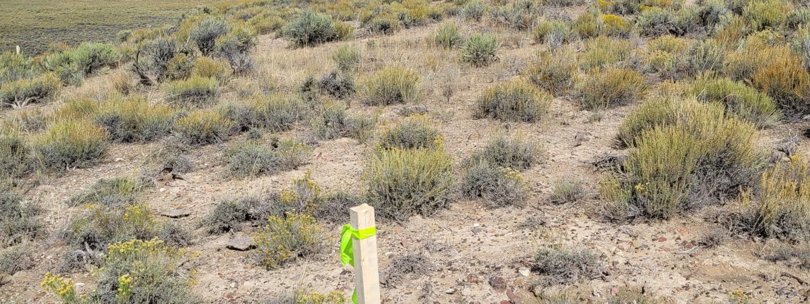
The upper Image Gallery below is from drilling in late 2025. The lower Image Gallery is from earlier staking and field programs.
Richard C. Capps, PhD, is the qualified person under National Instrument 43-101 that has approved the technical information contained within this website. Dr. Capps is the Company’s Senior Geologist and a Director.


